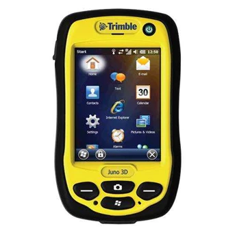
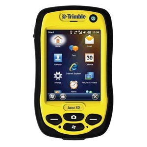
Detail GPS Mapping Trimble Juno 3D
Gps Trimble Juno 3D
Asset management for larger teams
Harness the strength of your distributed team to provide geo-enabled data you can trust. With theGps Trimble Juno 3D, your mobile workforce is empowered with a fully integrated, GPS-based data collection system for everyday field work. If your organization is managing critical assets, responding to emergencies or keeping an enterprise GIS current, you can increase efficiency— both in the field and in the office with dedicated asset management workflows and Gps Trimble Juno 3D
Delivered in a compact package resistant to dust, water, and shock, the Juno 3 provides a complete, integrated package of positioning, imaging and communications for total flexibility day after day.
3D model to suit your needs:
Product Models Juno 3D
Cellular voice & data Yes
Integrated camera 5 MP with Flash
The key to maximizing the productivity of your entire workforce everyday
The Trimble Juno 3 series is a compact integrated solution for your field workers, that will keep them connected and in touch.
As part of the Trimble family of GPS solutions, Juno 3 series handhelds are fully compatible with Trimble' s entire range of Mapping & GIS software, giving you a choice of GIS data collection and maintenance software solutions at a range of price points.
You can easily deploy Gps Trimble Juno 3Dhandhelds alongside your current Trimble equipment and maintain the same workflows and policies.
The Trimble Juno 3 series is the ideal platform for:
Utilities: Asset management, rapid response.
Local government: Asset management, issue reporting, emergency management.
Environmental management: Data collection.
KEY FEATURES
Rugged IP54 rating for tough outdoor conditions
Feature packed, fully integrated, affordable
3.75G cellular data and voice capability
High-sensitivity GPS receiver
5 megapixel autofocus camera with flash
Long life battery for all-day use
Lightweight and compact
All in one mobile solution
Combining the benefits of a GPS device, camera, PDA, and cellphone, this pocket-sized device provides work teams with a range of tools in a single compact package, so there are fewer batteries to charge and fewer devices to manage.
With a camera at the ready, your teams can document exactly what they see in the field. The Trimble Juno 3 combines photos with GPS so photos can be instantly geotagged for future reference. In addition, field to office collaboration is dramatically improved because photos can be sent from the field for review back in the office.
For standard positioning applications such as navigation, the high-sensitivity receiver delivers optimal yield so you can get a position fast in the harshest conditions. 2 to 5 meter positional accuracy is always available in real time in regions with SBAS coverage. In addition, accuracy can be further improved to 1 to 3 meters through simple postprocessing routines to meet company or regulatory standards.
Designed for GIS workflows and distributed teams
In GIS environments, data integrity and standardization is critical to maintain total workflow efficiency. Professional, geo-enabled data collection requires dedicated field software. The Trimble Juno 3 series is optimized for Trimble TerraSync™ software, Trimble Positions™ Mobile extension, and other industry-standard field software, so you can be confident that the data you receive back in the office is exactly what you need for streamlined integration into your enterprise GIS and fast updates
STANDARD FEATURES
System
Integrated data and voice capable 3.75G cellular with SMS capability ( Juno 3D only)
5 megapixel digital camera with geotagging, Juno 3D handheld has added LED Flash
Bluetooth® v2.0 wireless technology
802.11b/ g + WAPI wireless LAN
3.5 inch QVGA sunlight-readable color touch screen
Long-life, rechargeable, and removable Li-Ion battery
800 MHz processor
256 MB RAM
2 GB flash memory
1 microSD ( microSDHC compatible) memory card slot
Integrated speaker and microphone
Windows® Embedded Handheld 6.5 Professional in Chinese ( Simplified) , English, French, German, Italian, Japanese, Korean, Portuguese ( Brazilian) , Russian, or Spanish
GPS
High-sensitivity GPS/ SBAS1 receiver and antenna
Standard Software
Adobe Reader
Microsoft® Office Mobile® , includes Excel Mobile, Word Mobile, Internet Explorer Mobile, Outlook Mobile, and PowerPoint Mobile
TECHNICAL SPECIFICATIONS
Physical
Size138 mm x 79 mm x 31 mm ( 5.43 in x 3.11 in x 1.22 in)
Weight0.31 kg ( 0.69 lb) with battery
Processor800 MHz Samsung processor
Memory256 MB RAM and 2 GB built-in storage
Battery3060 mAh lithium-ion, rechargeable in unit
Power3
Low ( no GPS, backlight on4) 14 hours
Normal ( with GPS and backlight on) 10 hours
Environmental
Temperature
Operating-20 ° C to + 60 ° C ( -4 ° F to 140 ° F)
Storage-40 ° C to + 70 ° C ( -40 ° F to 158 ° F)
Humidity limit95% RH, non-condensing
Drop1.2 m ( 4 ft) drop plywood over concrete
2 drops per 6 sides at ambient temperature 23 ° C ( 73 ° F)
Tumble 100 cycles ( 200 drops) x 50 cm ( 1.64 ft) , 10 cycles/ minute
Casing IP54
Input/ Output
ExpansionmicroSD Card slot ( microSDHC compatible)
Display8.9 cm ( 3.5 in) QVGA ( 240 x 320 pixel)
resistive, sunlight readable, LED backlight
AudioBuilt-in microphone and speaker, record and playback utilities
I/ OUSB client v2.0 compliant
RadiosBluetooth 2.05 Wi-Fi 802.11b/ g
rated HSPA+ 3.75G cellular ( data and voice, Juno 3D only) 6
Digital camera5 megapixel color camera with autofocus
JPEG photo format, WMV video format, flash ( Juno 3D only)
GPS
Channels12 ( L1 code only)
Integrated real-timeSBAS1
Update rate1 Hz
Time to first fix30 seconds ( typical)
ProtocolsSiRF, NMEA-0183
Accuracy ( HRMS) 7 after differential correction
Code postprocessed81-3 m
Real-time ( SBAS1) 2-5 m
Standard Accessories
USB data cable
Stylus with lanyard
Wrist lanyard
Rechargeable Li-ion battery
International AC power supply
OPTIONAL FEATURES
Optional Software
Trimble TerraSync™ software
Trimble GPS Pathfinder® Office software
Trimble Positions™ software suite
Trimble GPScorrect™ extension for Esri ArcPad software
Trimble GPS Analyst™ extension for Esri ArcGIS for Desktop software
Trimble GPS Controller software
Trimble TrimPix™ Pro system
Trimble Municipal Reporter™ system2
Custom applications built with Mobile GIS Developer Community software development kits ( SDKs)
Optional Accessories
Vehicle power adapter
External GPS patch antenna
External battery charger
Carry case with belt clip
Clear screen protectors ( 2-pack)
Anti-glare screen protectors ( 2-pack)
Trimble LaserAce™ 1000 rangefinder
Range pole bracket
Vehicle-mount
Replacement Li-Ion battery
Replacement Stylus ( 2-pack)
Replacement AC Power supply
Tampilkan Lebih Banyak